
User login
Language
Anonymous's groups in this site
User is not a member of any group.
Your groups across all your sites
User is not a member of any group.
Recent Content
Who's online
There are currently 0 users online.
You are here
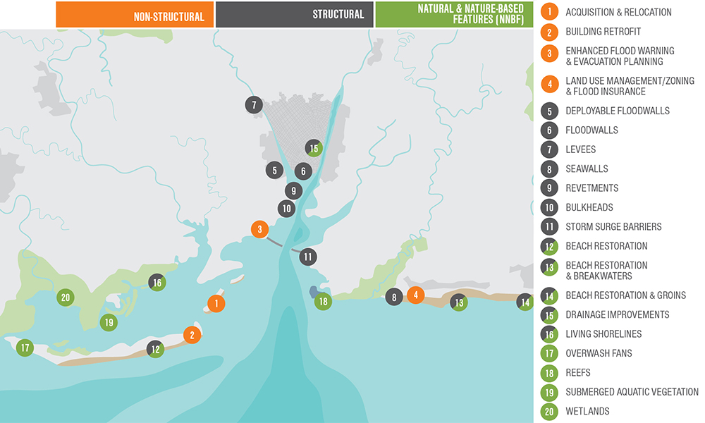
Image: This map shows various coastal storm damage risk management strategies communities can use to adapt to increased flood risk by 2100 (at a non-specific location). Although specific communities should consider a range of all possible solutions based on site-specific conditions, not all strategies to reduce coastal storm damage risk are structural solutions. A text-only version of this information is available at the bottom of the page.
nad.usace.army.mil
The U.S. Army Corps of Engineers recently completed a report detailing the results of a two-year study to address coastal storm and flood risk to vulnerable populations, property, ecosystems, and infrastructure affected by Hurricane Sandy in the United States' North Atlantic region.
This, the North Atlantic Coast Comprehensive Study, is designed to help local communities better understand changing flood risks associated with climate change and to provide tools to help those communities better prepare for future flood risks. It builds on lessons learned from Hurricane Sandy and attempts to bring to bear the latest scientific information available for state, local, and tribal planners.


Recent Comments